Chiroptera Carried Ocean and Land Laser Radar Mapping System
•Jilin General Aviation introduced the Leica Chiroptera carried underwater and land multifunctional laser scanning system in May 2013 .
•Multiple sensors;
•Integrating sensors for 35kHz sounding laser, 500kHz land laser dual LiDAR and 80 megapixel high resolution medium frame air survey camera
•Multifunction:
Proficient in many types of tasks, such as obtaining the submarine relief, coastal zone, land relief, high resolution multispectral image etc.
•Precise and fast:
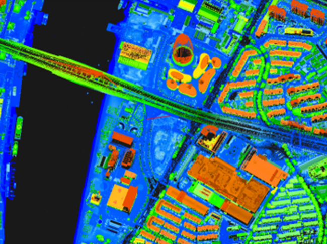
Acquire the underwater and land relief and image data within 15m in one flight by virtue of the 300m scanning width.
•Acquisition efficiency of underwater relief: 95km2/h
•Acquisition efficiency of land relief: 400km2/h
|
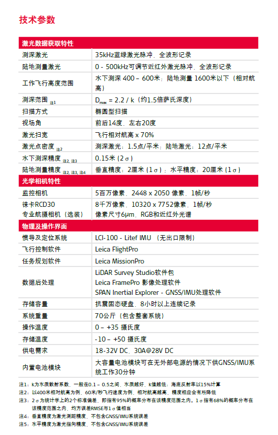
Laser data acquisition features
|
|
|
Sounding laser
|
35kHz blue-green laser pulse, full waveform recording
|
|
Land survey laser
|
0-500 kHz adjustable near-infrared laser pulse, full waveform recording
|
|
Flight altitude range of operation
|
For underwater sounding, 400-600m; for land survey, below 1600m (relative flying altitude)
|
|
Sounding range note 1
|
Dmax = 2.2 /k (approximately 1.5 times the Issa-like depth)
|
|
Scan method
|
Elliptic scanning
|
|
Field angle
|
14 degrees on the front and back, 20 degrees on the left and right
|
|
Laser scanning width
|
Relative flying height x 70%
|
|
Density of laser point note 2
|
Sounding laser: 1.5 points/m2; land laser: 12 points/m2
|
|
Underwater sounding accuracy note 2, note 3
|
0.15m (2 σ)
|
|
Land survey accuracy note 2, note 3, note 4
|
Vertical accuracy: 2cm (1 σ); horizontal accuracy: 20cm (1 σ)
|
|
Optical camera feature
|
|
|
Monitoring camera
|
5 mega-pixel, 2448 x 2050 pixels, 1 frame/sec
|
|
Leica RCD30
|
80 mega-pixel, 10320 x 7752 pixels, 1 frame/sec
|
|
Professional areophoto camera (optional)
|
Pixel dimension 6 μm, RGB and near-infrared spectrum
|
|
Physical and operation interfaces
|
|
|
Inertial navigation and positioning system
|
LCl-100-Litef IMU (no output limit)
|
|
Flight control software
|
Leica FlightPro
|
|
Mission planning software
|
Leica MissionPro
|
|
Data post-processing
|
LiDAR Survey Studio software package
Leica FramePro image processing software
SPAN Inertial Explorer – GNSS/IMU processing software
|
|
Storage capacity
|
Shock-proof SSD, over 8h of continuous recording
|
|
System weight
|
70kg (including the whole system)
|
|
Operating temperature
|
0 - +35 ℃
|
|
Storage temperature
|
-10 - +50 ℃
|
|
Power supply requirement
|
18-23V DC, 30A@28V DC
|
|
Built-in battery module
|
Large capacity battery module, providing 30min of operation
for GNSS/IMU system without external power |

|
评论加载中...
|