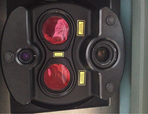
1.Jilin General Aviation introduced the Leica Chiroptera underwater and land multifunctional laser scanning system in May 2013.
•Multiple sensors
Integrating sensors for 35kHz sounding laser, 500kHz land laser dual LIDAR and three sensors 80 megapixel high resolution medium frame air survey camera
•Multifunction:
Proficient in many types of tasks, such as obtaining the submarine relief, coastal zone, land relief, high resolution multispectral image etc.
•Precise and fast:
Acquire the underwater and land relief and image data within 15m in one flight by virtue of the 300m scanning width.
•Acquisition efficiency of underwater relief: 95km2/h
•Acquisition efficiency of land relief: 400km2/h
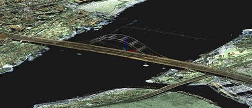
Waitan Major Bridge of Ningbo

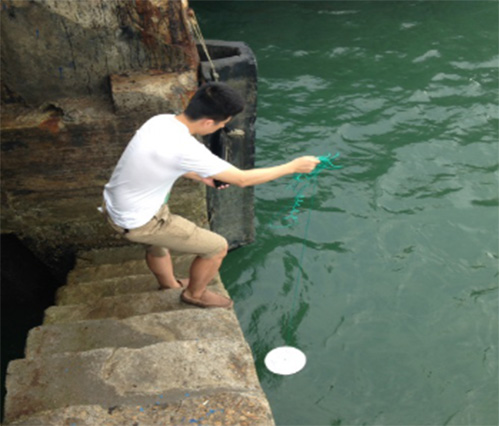
2.Water depth project: During the earlier stage preparation of the project, our field workers measured the water quality in the survey area. The measured water transparency was 2-3m at the 12 survey points, which was in accordance with the predictive value of remote sensing data.

|
评论加载中...
|